


Print Profile(1)

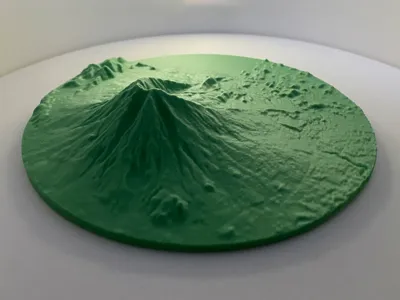
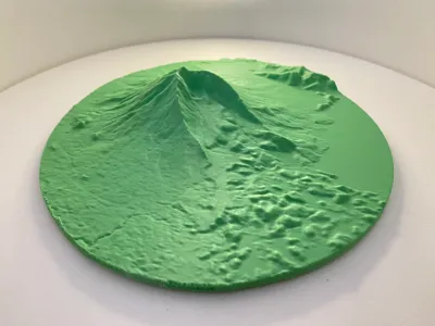
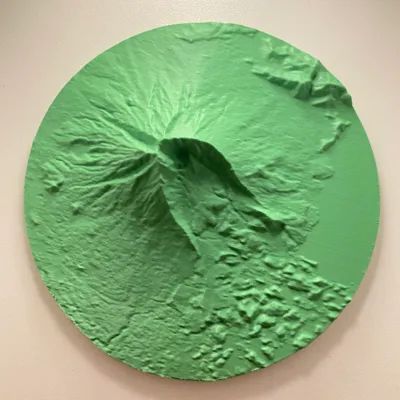
Description
1.5x vertical exaggeration
Printed in Polyterra PLA Forest Green
Minimal supports needed when using 0.12mm layer height
GEOLOGY
Mt. Iriga (locally named Asog) has a breached crater opening to the southeast formed by a colossal debris avalanche which also dammed a river eventually forming Lake Buhi. This is similar in size to the famous 1980 collapse of Mt. St. Helens which left a 2.8 cu. km. debris avalanche deposit. Meanwhile, the volume of the Buhi debris avalanche deposit is estimated to be 2.5-3.1 cu. km. based on 3D reconstruction and shallow seismic reflection.
Farther down, beyond the horseshoe-shaped amphitheatre are mounds and ridges known as hummocks left behind as the debris avalanche fanned out onto the surrounding topography until being blocked by Mt. Malinao. The collapse, while not magmatic in origin, is likely related to strike-slip faulting under the volcano similar to that seen in analogue sand cone experiments.
DATA
Copernicus GLO-30 Digital Elevation Model - https://portal.opentopography.org/raster?opentopoID=OTSDEM.032021.4326.3
TOOLS
QGIS (DEMto3D Plugin)
Blender
Comment & Rating (0)