


Print Profile(1)

Description
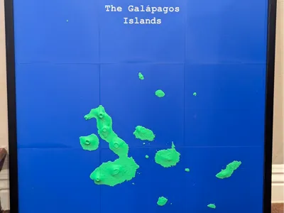
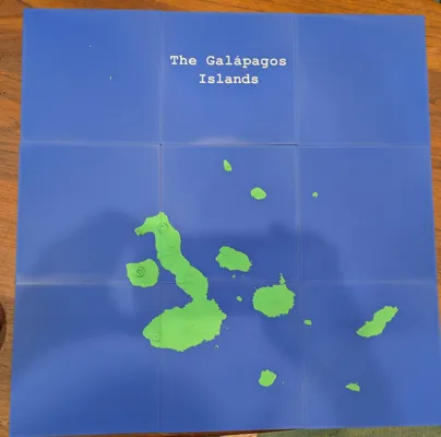
This is a topographic map of the Galápagos Islands in 9 plates. Each plate is 186.5mm x 186mm and 3mm high at sea level. Put together they fit nicely in a 22in x 22in picture frame (with glass or acrylic front removed).
I used Terrain2STL (https://jthatch.com/Terrain2STL) with 3X vertical scaling to make this map. Then, I cut it into 9 plates.
0.12mm High Quality
I used Sunlu Matte PLA Oak for the sand layer which I intentionally made very thin. One could expand it with layer coloring or remove it entirely.
License
You shall not share, sub-license, sell, rent, host, transfer, or distribute in any way the digital or 3D printed versions of this object, nor any other derivative work of this object in its digital or physical format (including - but not limited to - remixes of this object, and hosting on other digital platforms). The objects may not be used without permission in any way whatsoever in which you charge money, or collect fees.
Comment & Rating (2)