Aachen Topographic City Map Display


Print Profile(1)

Description
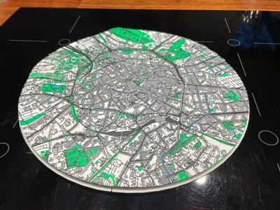
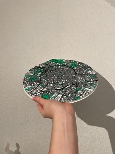
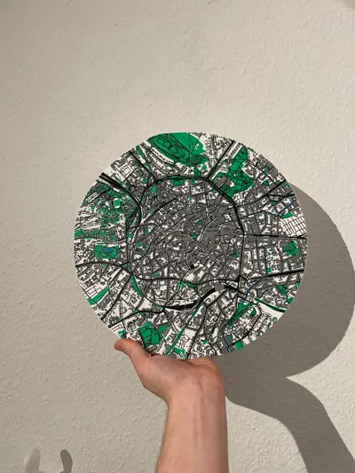
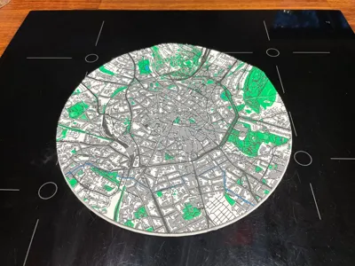
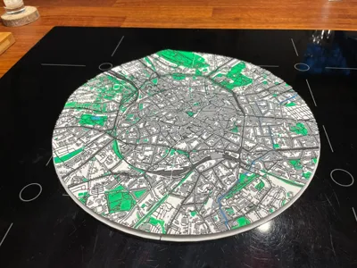
This is a highly detailed, multi-color topographic display of the city of Aachen (Germany), printed as a large 300 × 300 × 17 mm circular map.
The model is divided into 4 individual quadrants (each 150 × 150 mm) that connect seamlessly using small alignment pins. Once assembled, the pieces form a perfect round representation of Aachen’s urban layout.
The map includes many recognizable landmarks and structures, such as:
- Aachen Cathedral (Dom)
- RWTH Aachen University buildings
- Aachen Hauptbahnhof
- Ponttor
- Lousberg and surrounding elevation features
- Major street networks, parks, and urban green areas
The result is a textured, layered topographic look that stands out beautifully on a wall or shelf.
🎨 Color Setup (5 Filaments)
This model uses five distinct colors:
- White → Base layer
- Light Gray → Buildings
- Black → Streets & outlines
- Blue → Water
- Green → Parks & green areas
Optimized for the Bambu Lab H2D (dual extruder), but also printable on any Bambu Lab printer using AMS.
⚙️ Printing Details
- No supports required
- Arachne slicing recommended for sharper details in buildings and roads
- Approx. print time per segment: ~8 hours
- Total print time: ~1.5 days for all four pieces
- Assembly: snap-fit with small connecting pins
License
You shall not share, sub-license, sell, rent, host, transfer, or distribute in any way the digital or 3D printed versions of this object, nor any other derivative work of this object in its digital or physical format (including - but not limited to - remixes of this object, and hosting on other digital platforms). The objects may not be used without permission in any way whatsoever in which you charge money, or collect fees.
Comment & Rating (1)