


Print Profile(1)

Description
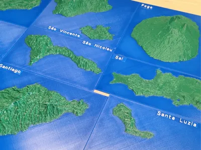
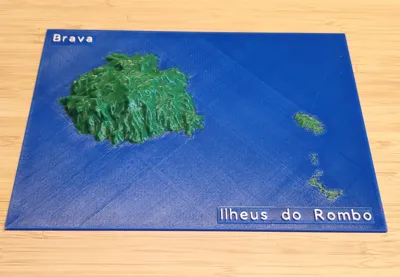
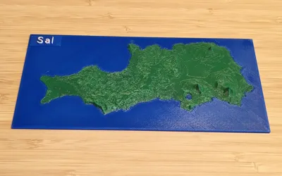
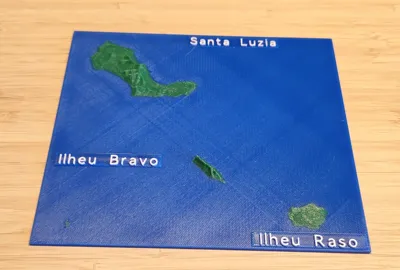
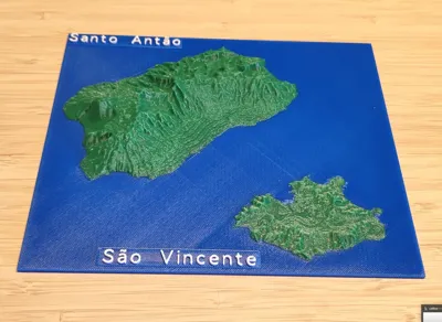
This set includes all the islands of Cabo Verde, modeled in 3D terrain with 1.5× vertical exaggeration for better relief detail. Each plate is oriented with north pointing up. An extra plate with name tags is included, so you can glue the labels onto the islands once printed.
Islands Overview
- Santo Antão
- Area: ~779 km²
- Population: ~36,000
- Highest point: Tope de Coroa, 1,979 m
- São Vicente
- Area: ~227 km²
- Population: ~76,000
- Highest point: Monte Verde, 744 m
- Santa Luzia (uninhabited)
- Area: ~35 km²
- Population: 0
- Highest point: 395 m
- São Nicolau
- Area: ~343 km²
- Population: ~13,500
- Highest point: Monte Gordo, 1,312 m
- Sal
- Area: ~219 km²
- Population: ~39,000
- Highest point: Monte Grande, 406 m
- Boa Vista
- Area: ~620 km²
- Population: ~20,000
- Highest point: Monte Estância, 387 m
- Maio
- Area: ~269 km²
- Population: ~7,000
- Highest point: Monte Penoso, 436 m
- Santiago (largest island)
- Area: ~991 km²
- Population: ~273,000
- Highest point: Pico da Antónia, 1,394 m
- Fogo
- Area: ~476 km²
- Population: ~35,000
- Highest point: Pico do Fogo, 2,829 m (active volcano)
- Brava
- Area: ~67 km²
- Population: ~6,000
- Highest point: Monte Fontainhas, 976 m
Ilhéus (islets) – Branco, Raso, etc.
- Small, uninhabited volcanic islets near Santa Luzia.
- Important bird sanctuaries.
This set is great for classrooms, geography projects, or as a display piece to show the unique volcanic landscapes of Cabo Verde.
License
You shall not share, sub-license, sell, rent, host, transfer, or distribute in any way the digital or 3D printed versions of this object, nor any other derivative work of this object in its digital or physical format (including - but not limited to - remixes of this object, and hosting on other digital platforms). The objects may not be used without permission in any way whatsoever in which you charge money, or collect fees.
Comment & Rating (0)