Search models, users, collections, and posts
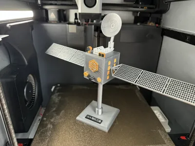
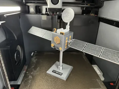
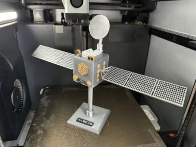
Beidou Navigation Satellite
IP Report


Print Profile(2)

0.2mm layer, 2 walls, 15% infill
Designer
10.5 h
3 plates

0.2mm layer, 2 walls, 15% infill
Designer
9.8 h
1 plate
Open in Bambu Studio
Boost
17
60
1
0
82
26
Released
Description
Content has been automatically translated.
I couldn't find accurate and detailed satellite pictures and videos, so I drew this model based on existing online images and videos, combined with my own imagination and understanding. For convenient printing, I printed each surface separately and then assembled them with the main body using glue. The solar panels and brackets on both sides are connected to the main body with pins. The filament used for the model is Bambu Lab PLA Basic in gold, silver, black, and white
The Beidou Navigation Satellite System (BDS, also known as COMPASS, Chinese transliterated name: BeiDou) is a global satellite navigation system independently developed by China, and it is the third mature satellite navigation system after GPS and GLONASS. The Beidou Navigation Satellite System (BDS), along with the US GPS, Russia's GLONASS, and the EU's GALILEO, are recognized providers by the United Nations International Committee on Global Navigation Satellite Systems.
The Beidou Navigation Satellite System consists of three parts: the space segment, the ground segment, and the user segment. It can provide high-precision, highly reliable positioning, navigation, and timing services to various users worldwide, 24/7, and also has short message communication capabilities. After years of development, the Beidou system has become an important new infrastructure providing all-weather, all-time, high-precision positioning, navigation, and timing services to global users [87]. The Beidou system's positioning, navigation, and timing services are provided free of charge to global users through 30 satellites, with global horizontal positioning accuracy better than 9 meters, vertical positioning accuracy better than 10 meters, velocity measurement accuracy better than 0.2 meters/second, and timing accuracy better than 20 nanoseconds [87].
137 countries worldwide have signed cooperation agreements with the Beidou Navigation Satellite System. With the successful completion of global networking, the future international application space of the Beidou Navigation Satellite System will continue to expand [2].
At 11:26 on December 26, 2023, China launched the 57th and 58th Beidou navigation satellites using a Long March 3B carrier rocket and a Yuanzheng-1 upper stage at the Xichang Satellite Launch Center. This group of satellites belongs to medium Earth orbit satellites and is the first group of MEO satellites launched after the completion and activation of China's Beidou-3 global satellite navigation system. After entering orbit and completing in-orbit testing, they will be integrated into the Beidou Navigation Satellite System [86].
On September 19, 2024, China launched the 59th and 60th Beidou navigation satellites at the Xichang Satellite Launch Center.
License
This user content is licensed under a Standard Digital File License.
You shall not share, sub-license, sell, rent, host, transfer, or distribute in any way the digital or 3D printed versions of this object, nor any other derivative work of this object in its digital or physical format (including - but not limited to - remixes of this object, and hosting on other digital platforms). The objects may not be used without permission in any way whatsoever in which you charge money, or collect fees.
Comment & Rating (1)