EarthBall: Palm-Sized Topographic Globe


Print Profile(1)

Description
Boost Me (for free)
Feel free to boost me to support my work! It's totally free for you, and helps me out a ton!
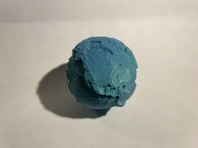
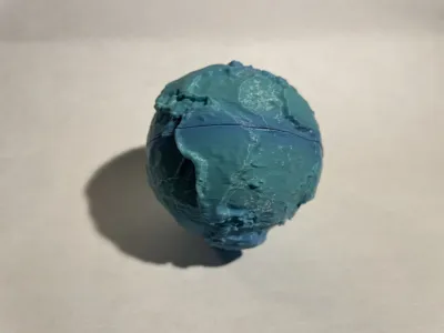
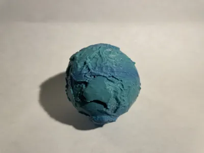
EarthBall is a realistic, fully accurate scale model of the Earth! Experience our world in just the palm of your hand.
I created this model by combining NASA topographic (land elevation) and bathymetric (underwater elevation) maps, which result in a model of the globe if all the water was drained. I couldn't find another similar model, where there was both the elevation of land and water, and that I could hold and toss around like a baseball.
Assembly is very easy, just align the top and bottom, insert the alignment peg (you may have to sand it down a little to fit), and push the parts together. I do recommend using superglue to hold the pieces together much more strongly, and you may want to clamp the parts together while the superglue is drying.
Please note:
- the height is exaggerated significantly to make it visible
- the drop-offs you see that resemble the continents aren't actually where the real coastlines are, they are the continental shelf, where the ocean becomes much deeper
- Greenland and Antarctica look extremely elevated in this model, that is because it is based on the top of the ice (which gets pretty high), instead of the bedrock below
License
You shall not share, sub-license, sell, rent, host, transfer, or distribute in any way the digital or 3D printed versions of this object, nor any other derivative work of this object in its digital or physical format (including - but not limited to - remixes of this object, and hosting on other digital platforms). The objects may not be used without permission in any way whatsoever in which you charge money, or collect fees.
Comment & Rating (1)