Roadbook - Navigation for hiking, biking, etc.


Print Profile(1)

Description
The Roadbook – No unwieldy folding maps, no GPS, and no power required – just a little preparation. A simple technique long used in rally racing – even today! Whether as full navigation, emergency navigation, a new challenge, for children's birthday parties, or just for fun.
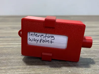
Assembly: Assembly is self-explanatory. It is important that the small recess points downwards as shown in the photo. Tolerances are very tight, so depending on the printer, some sanding or gluing may be necessary, but the model is designed simply to be assembled.
Planning: Carefully plan your route in advance and note down prominent waypoints on a strip of paper (approximately 44mm wide), for example, “Turn right at Bambu Mountain” or “500 steps after the AMS River”. If you have a compass, you can also use compass directions; for longer hikes, include village names.
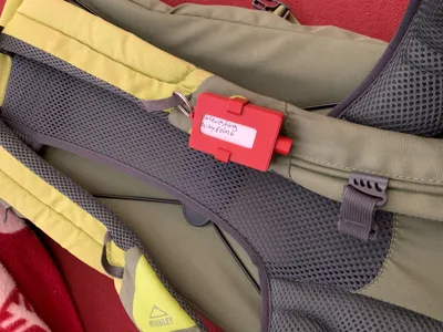
Rolling Up: Easy – simply make a small crease at the top and bottom, insert the bottom into the roll first, roll it up, insert the top into the roll, make one rotation, and you're done. Put on the lid, add a clip, and off you go!
Have Fun: Embark on your adventure! Once you reach your first waypoint, simply continue and follow your waypoints.
Everything is essentially self-explanatory and documented with photos, but if you still have any questions, feel free to contact me :-)
License
You shall not share, sub-license, sell, rent, host, transfer, or distribute in any way the digital or 3D printed versions of this object, nor any other derivative work of this object in its digital or physical format (including - but not limited to - remixes of this object, and hosting on other digital platforms). The objects may not be used without permission in any way whatsoever in which you charge money, or collect fees.
Comment & Rating (11)