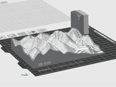
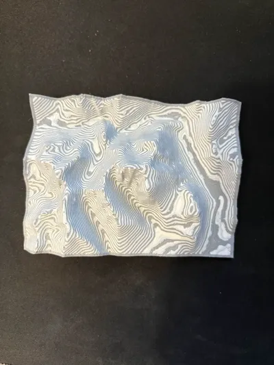
Ben Nevis Contour Map


Print Profile(1)

Description
Ben Nevis 3D Terrain Model with Contour Lines – Multi-Color Print
This detailed 3D-printed model of Ben Nevis brings topographic maps to life, making it an useful tool for Scouts, Army Cadets, geography students, and outdoor enthusiasts learning map-reading skills.
Featuring highlighted contour lines, this model helps visualize elevation changes, terrain features, and the steep gradients of the UK's highest peak.
Printed using a multi-coloUr AMS (Automatic Material System), each elevation layer is distinctly highlighted, providing a clear and intuitive representation of the mountain’s shape. This hands-on educational tool enhances navigation training, allowing users to better understand how map contours translate to real-world landscapes.
Perfect for schools, outdoor training programs, and geography classrooms, this model serves as a tactile and visual aid to improve spatial awareness, topographic interpretation, and outdoor safety.
Ideal for:
✅ Map reading practice
✅ Duke of Edinburgh & hillwalking training
✅ Scouts and cadet navigation exercises
✅ STEM and geography education
Bring topography to life with this interactive learning tool!
Comment & Rating (2)