Salkantay Trek to Machu Picchu, Peru – Topographic Map


Print Profile(1)

Description
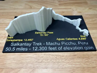
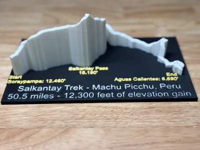
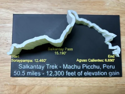
Inspired by MakerWorld user @chugalug, here is a fun 3D relief map of the Salkantay Trek to Machu Picchu, Peru. I did the trek with my wife and have outstanding memories of it. I simply took the GPX file from the hike and converted it here: https://gpxtruder.xyz/
Then I imported into Fusion360 to make the baseplate and text.
Please note that if you use a 0.4 nozzle like I did, the commas in the smaller yellow text will print as periods. However, fun fact, this is actually how Peru denotes their numbers in the thousands so it's a win! You can probably use a 0.2 nozzle if that bothers you though.
Boost Me (for free)
Thanks for the boost!
License
You shall not share, sub-license, sell, rent, host, transfer, or distribute in any way the digital or 3D printed versions of this object, nor any other derivative work of this object in its digital or physical format (including - but not limited to - remixes of this object, and hosting on other digital platforms). The objects may not be used without permission in any way whatsoever in which you charge money, or collect fees.
Comment & Rating (4)