Layered Earth Map - Bathymetry and Topography


Print Profile(1)

Description
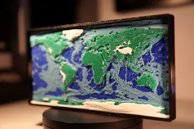
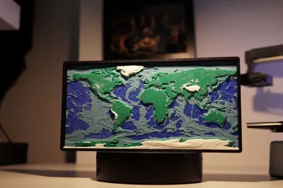
Layered Earth Map

A 3D-printed layered map of Earth's bathymetry and topography showcases the planet's underwater depths and surface elevations in intricate detail.

Really need to open that rotator thingie and see why is it bumping :S
Using elevation and depth data, this model represents ocean trenches, mountain ranges, and continental land forms with precise layering, offering a tangible and visually striking way to explore Earth's geography.

Perfect for educational purposes, scientific study, or decorative display, this map brings the hidden underwater world and towering landscapes to life.
It's a relatively fast print, and you do not need AMS, simply pause and change filament at the designated spots you can see in the slicer. There is a frame included in the file, printed face down so you get a nice finish on the front. A bit loose fitting due to tolerance some folks may have, secure it with a dab of super glue on the back.
In the second revision, I added a gentler slope to Greenland and other details.

Boost Me (for free)
Thanks!
Other models you may want to check out :)

License
You shall not share, sub-license, sell, rent, host, transfer, or distribute in any way the digital or 3D printed versions of this object, nor any other derivative work of this object in its digital or physical format (including - but not limited to - remixes of this object, and hosting on other digital platforms). The objects may not be used without permission in any way whatsoever in which you charge money, or collect fees.
Comment & Rating (10)