


Print Profile(1)

Description
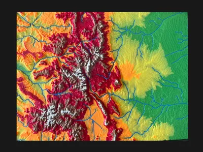
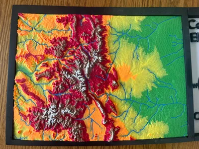
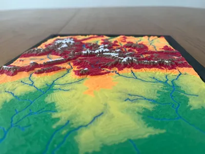
This 3D-printed relief map of Colorado is a stunning and detailed representation of the state’s diverse topography. Designed with precision, it captures the dramatic elevation changes, from the towering Rocky Mountains to the rolling plains, with an engaging mix of color and texture.
Features:
• Topographic Elevation: The map uses a vibrant color gradient, transitioning from green (lowlands) to yellow, orange, red, and white (highest peaks) to highlight Colorado’s mountainous terrain.
• Hydrography: Major rivers and waterways are accurately depicted in blue, showcasing Colorado’s extensive river systems that shape the landscape.
• Detailed Relief: The raised surface brings the topography to life, allowing users to feel the contours of mountain ranges, valleys, and plateaus.
• Educational and Display-Ready: Encased in a sleek border, this model is perfect for classrooms, museums, or as a decorative piece for geography enthusiasts.
Comment & Rating (1)