


Print Profile(1)

Description
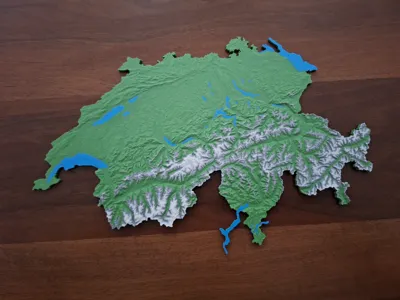
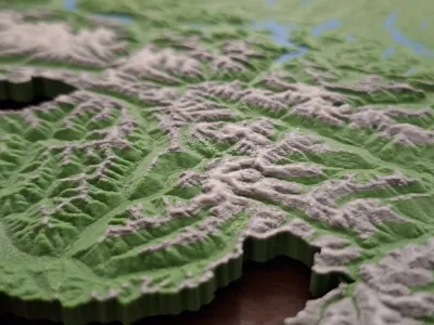
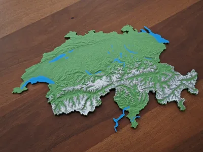
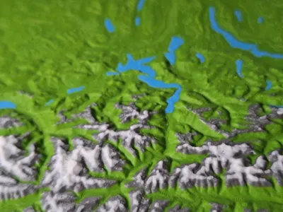
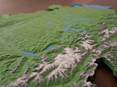
This is a highly detailed relief map of Switzerland. You can recognize almost every single valley, every mountain range, and most of Switzerland's mountains. The coloring of the lakes, mountains, and snow-capped peaks makes the map appear particularly realistic.
Some information about the model
- The lakes are modeled as separate bodies so that they can be easily colored blue
- The mountains and their snow-capped peaks are colored in gray and white using layer height
- The following colors from the Bambu Lab PETG HF range are recommended: Forest Green, Lake Blue, Gray, White
- The following colors from the Bambu Lab ABS range are recommended: Olive, Azure, Silver, White (according to photos)
- The border lakes are modeled in their entirety, as this looks more natural. Fun fact: The border between Switzerland and Germany on Lake Constance is not regulated. The border between Switzerland and France is marked on the model with a groove in Lake Geneva (Lac Léman).
Boost Me (for free)
Do you like my model? Then now would be the time to donate a free boost so that others can find out about it too. Thank you very much.
At this point I would like to thank c.hammelmann for the inspiration and preliminary work on the terrain data and for allowing me to publish the further developed model.
License
You shall not share, sub-license, sell, rent, host, transfer, or distribute in any way the digital or 3D printed versions of this object, nor any other derivative work of this object in its digital or physical format (including - but not limited to - remixes of this object, and hosting on other digital platforms). The objects may not be used without permission in any way whatsoever in which you charge money, or collect fees.
Comment & Rating (26)